WW II Japanese Air Crew Buried Under Ewa Beach Hawaii Golf Course
By William Cole
The Honolulu Star-Advertiser
October 31, 2014
HONOLULU — Out at the Hoakalei Country Club in Ewa Beach, near the 18-hole golf course's clubhouse, may be something that definitely doesn't belong: the hastily buried remains of a Japanese aircrew whose dive bomber went down Dec. 7, 1941, during the attack on Pearl Harbor.The Aichi D3A "Val," piloted by Petty Officer 2nd Class Koreyoshi Toyama and with Flier 1st Class Hajime Murao aboard, either crashed in midair with a U.S. Navy plane or was shot down and, amazingly, ended up in the same spot as the downed Navy plane, according to varying accounts.
The 20-year-old Toyama (also known as Sotoyama) attacked the USS Pennsylvania in Drydock 1. His bomb missed and hit the dock itself, said Pearl Harbor historian David Aiken.
Following his unit, Toyama flew to Ewa Mooring Mast Field, where he was shot down by famed Pearl Harbor defender Ken Taylor in a P-40 fighter, Aiken maintains.
The two U.S. Navy men, Ensign John H.L. Vogt and Petty Officer 3rd Class Sidney Pierce, a radioman-gunner, bailed out, but at an altitude too low to survive.
An ambulance came to recover the Navy aviators.
What happened to the Japanese air crew 73 years ago has remained a topic of interest for historians and, more recently, their families back in Japan.
Ewa Beach historian John Bond said he believes he has zeroed in on the crash and likely grave site, and wants developer Haseko (Hawaii) Inc. to allow a professional search for the bodies and placement of a marker memorializing the aircrew's loss.
The state of Hawaii should exercise some resolve, he said.
"It's a crash site, and there are foreign nationals buried there," he said.
Sharene Saito Tam, a Haseko representative, said in an email that "extensive" archaeological surveys throughout the property in the 1990s and ongoing archaeological monitoring of construction activities "have not uncovered any evidence of burials of any air crews on the site."
However, she added, "We're reviewing the original (historical) documents so we can verify their authenticity and substantiate the location before considering a marker emplacement."
Haseko Hawaii recently sold Hoakalei Country Club to Hirakawa Shoji Group of Japan, and the new company is expected to begin operating the golf course in December.
Tom Dye, who did archaeological work for Haseko, said coordinates for the site of the crashed Japanese and American planes provided by the U.S. military in 1942 do fall within Haseko property.
More specifically, that location is now a water feature for the golf course, Dye said.
Haseko also developed the adjoining Ocean Pointe community.
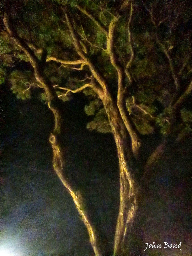
Bond suspects the Japanese aircrew, burned in the crash, were buried close to the aircraft in a karst coral sinkhole as a matter of expediency.
The crash site — and the smoke plume rising above it — likely was photographed by Staff Sgt. Lee Embree on Dec. 7, 1941, from a B-17 bomber that arrived over Oahu during the attack.
Accounts from the time also suggest the Japanese crew was buried nearby.
In a Dec. 9, 1941, report, Capt. Lester Milz with the 251st Coast Artillery said he arrived Dec. 7 and saw two parachutes in trees and the dead American aviators, Vogt and Pierce.
"Two Japanese pilots, both badly burned, were also in the wreck," Milz wrote. "My men disposed of the remains of the Japanese, and found that both had been killed with .50 caliber through the body."
Pvt. Clement Hauger Jr. with the 251st said he and another soldier walked a "city block" from their gun emplacement and found the Japanese plane burning, according to a report provided by Aiken.
"Holes in the coral were located and the bodies were put in," Hauger said.
Capt. Anthony Long, also with the 251st, wrote in his diary on Dec. 11, 1941, that at Milz's battery he "looked & checked both Jap & U.S. plane that landed at his position. He buried both Japs in a coral grave. Jap planes made or assembled with many American parts — what a situation."
Bond said it was often standard practice to bury aircrew casualties next to a crash site so mortuary affairs could find the bodies later.
During and after the Dec. 7 attacks, Japanese casualties were not a priority, however, historians admit.
In fact, 33 Japanese airmen and sailors remain unaccounted for at sea and on land around Hawaii from the attacks, officials have said.
Dye, the archaeologist, said it's not known where the Japanese aircrew is buried.
Another Japanese "Val" crashed offshore Dec. 7, and pilot Gen Goto brought his mortally wounded radioman, Michiji Utsugi, to shore, where it's said Goto engaged in a gunfight with the 55th Coast Artillery Corps until he was killed.
Dye said a Dec. 19, 1941, Honolulu Star-Bulletin story reported the bodies were taken to Camp Malakole and then back to the beach, where they were buried.
Dye's point was that the bodies were transported before they were buried.
"There might be as many as four different (Japanese) bodies actually buried there that nobody has accounted for, ever dug up, and quickly forgot," said military historian Jim Lansdale, who lives in Florida.

The problem is locating the specific spot where the bodies are buried, he said.
Dye said the area identified by military coordinates as the crash site was cultivated with sugar cane from the 1950s through the 1970s.
Developer bulldozers "have destroyed any clues" to the location of the co-located crashes, but the karst sinkhole burial depth may have kept it intact, said Aiken, the historian.
Bond would like to see a memorial marker, but he also advocates a search for the grave, noting that the coordinates given by the military in 1942 are not exact.
"It is possible to find remains because the technology is there," he said. "The site has the potential of revealing sinkholes underground. Of course it would be a long shot, but it's possible."
Aiken said contact has been made with families of the Japanese aircrew. Murao has an older sister, but she is too aged to participate in any marker dedication, he said.
The Toyama family has a member interested in coming to Hawaii, Aiken said. He also said he has reached out to the family of Vogt, one of the U.S. Navy airmen whose plane crashed in the same spot.
Tour of December 7, 1941 Ewa Field, US Navy SBD And Japanese Aichi Val Crash Sites
by John Bond, Ewa Battlefield historian

Thomas Z Reese Photo
September 24, 2014
MCAS Ewa Tour Visits Bullet Marked 1941 Ewa Field, 1942 Marine Fighter Aircraft Revetments and December 7, 1941 Crash Site Area of Val and SBD.

Four US Navy SBD's from the USS Enterprise were shot down over Ewa on
December 7, 1941 by Zero fighters killing six of eight airmen,
while Army P-40's shot down four Japanese airmen and three other Army pilots
died in two civilian planes shot down- yet today this Ewa air battle
history and those who died have been virtually unrecognized and forgotten...
died in two civilian planes shot down- yet today this Ewa air battle
history and those who died have been virtually unrecognized and forgotten...

National Archives photo shows where the Japanese Val and Navy SBD crashed, as taken from a passing B-17E bomber attempting a landing at nearby Hickam Field.

Jack Matthews series depicts shot up Aichi Val heading for crash landing off Ewa shore

Lee Embree photo shows the two Aichi Val wingmen passing by the large B-17E

Army P-40 fighters are credited with shooting down Aichi Val dive bombers over Ewa
****************************************************
Ewa Tour Visits Bullet Marked 1941 Ewa Field, 1942 Marine fighter aircraft revetments and December 7, 1941 crash site area of D3A Aichi "Val" and US Navy SBD that killed four air crew.
Four US Navy planes, two Japanese planes and two civilian planes were shot down over Ewa killing 13 airmen, which isn't even the full extent of the Ewa air battle action nearly totally forgotten today.
The Japanese air crew remain buried at the crash site.
Thomas Z Reese Photos
.JPG)
Tour begins at 1941 bullet marked Ewa Field and then to 1942 fighter plane revetments

The defensive 1942 fighter plane revetments explained as a reaction to Ewa Field air attack

Pearl Harbor historian Daniel Martinez provides historic context of the Ewa battlefield
Pearl Harbor historian Daniel Martinez provides historic context of the Ewa battlefield

Ewa Cultural Practitioner Michael Kumukauoha Lee explains iwi as sacred to Hawaiians

Japanese interpreter Stacy Smith does a remarkable job translating the historic information

Ewa Cultural Practitioner Michael Kumukauoha Lee provides a prayer-chant for the iwi

Pearl Harbor historian Daniel Martinez explains the Val crash and NPS museum artifacts

September 24, 2014 Shubun no hi crash area visitors offers leis in observance of
killed American and Japanese aviators. The Japanese air crew remain buried on the site.
This mound is NOT the actual crash site, which has yet to be specifically located.
**********************************************************
Shubun no hi / 秋分の日
The origin of Higan—a seven-day festival marking the vernal equinox, Shunbun-no-hi is unknown, but has been widely observed in Japan since the eighth century. The autumn equinox generally happens around September 23 of each year and is known as Shubun no hi.
The word higan means “the other shore,” a Buddhist term that comes from the idea that there is a river marking the division of this life from the world of salvation. This river is full of illusion, passion, and sorrow, and only by crossing to the other shore can one gain enlightenment and enter nirvana. It is said that, when night and day are equal (as occurs on the equinox) the Buddha appears on earth to save stray souls and help them make the crossing. Thus the visit to the family cemetery on this occasion is a happy event.
*********************************************************

Shot down Navy SBD airmen flew off the USS Enterprise (CV-6) on the morning of
December 7, 1941 not knowing they were arriving during the attack on Pearl Harbor.

Photos show progression of Haseko development and the Val and SBD crash site area
Also see below:
* Four US Navy USS Enterprise SBD's Shot Down In Same Ewa Crash Site Area
* Virtual 360 Views of December 7, 1941 Ewa Battlefield Crash Site Areas
* Further Ewa Battlefield Historic Notes and Details:
There are currently still 9 US American airmen listed as missing from the December 7, 1941 attack on Pearl Harbor, Oahu. – In the Ewa air battle five were from the USS Enterprise, three from the 251st US Army Coastal Artillery Regiment.
Ewa Air Combat Participants – Americans
Army pilots in two civilian trainers
The very first Americans to die were very likely the three US Army soldiers flying in two rented planes along the Ewa shoreline. The Ewa shoreline was a very good flight training area and remains so today. Also these three private pilots were with the 251st Coast Artillery, a federalized California National Guard unit that had gun positions along the same Ewa coastline. CAP Zeros swooped in and quickly shot down both planes which plummeted into the sea.
On the morning of December 18, 1941 Dr. Dai Yen Chang, a prominent Honolulu dentist, was walking on the beach in Puuloa (Ewa Beach area) when he found a large piece of bright yellow doped fabric and what appeared to be a section of an airplane's outer wing panel. A Civil Aeronautics Authority inspector later positively identified the wreckage as having come from one of the K-T Cubs rented by the Army soldiers.
On the afternoon of December 31, 1941, Washed up on the beach was a brown Army service shoe containing a badly decomposed human foot encased in a waterlogged Army-issue sock. Eventually this shoe was determined to have belonged to 20-year-old Sergeant Henry C. Blackwell, one of the two Camp Malakole private pilots.
USS Enterprise SBD’s
There is much more to this entire USS Enterprise SBD story but here is a synopsis of what happen over or near Ewa. Some of the surviving SBD’s landed at Ewa Field and Ford Island.
SBD-2 (6-B-3) #2181, Ensign Manuel Gonzalez and RM3 Leonard Joseph Kozelek were the aircrew aboard and were shot down by Zero CAP off Oahu’s west shore with no remains located. This was not actually near Ewa but Ensign Gonzalez may have been the first Navy plane shot down by CAP Zeros and his final radio report alerted some of the other planes that they were being fired on by unknown aircraft.
SBD-2 (6-S-9) #2158, Ensign John Reginald McCarthy and RM3 Mitchell Cohn were the aircrew aboard and were shot down by Zero CAP over Ewa and believed to have crashed on land in the vicinity of Puuloa. A Navy crash site photo was made but the exact location has been currently lost. Ensign McCarthy successfully bailed out at low altitude but suffered a broken leg. However RM3 Cohn may have been wounded with no chance to bail out and went down with the plane. His remains were never found.
SBD-2 (6-S-15) #2159, Ensign Walter Michael Willis and Coxswain Fred John Ducolon were the aircrew aboard and were shot down by Zero CAP and crashed into the sea off the Ewa shore. No remains of this plane or crew have ever been found.
SBD-2 (6-S-3) #2160, was flown by Ens John H L Vogt Jr and RM3 Sidney Pierce was shot down by Zero CAP and crashed at a site area which is today the Haseko Hoakalei Golf Course club house. By very amazing coincidence this is the same location where the Japanese Val crashed. Both Navy SBD aircrew remains were recovered. The Japanese aircrew reported as badly burned and with bullet wounds were buried at the crash site and never later recovered. Also by amazing coincidence this burning crash site was captured on film by Army photographer Lee Embree in a B-17e attempting a landing at Hickam Field. The two Japanese Val wingmen briefly attacked the large four engine bomber but then left unaware that it was not armed.
SBD-2 (6-S-4) #4570, Lieutenant C. E. Dickinson Jr., and William C. Miller, RM1c, were shot down by Zero CAP and crashed at a site area which is today a housing area off Fort Weaver Rd. (91-1037 Ka'Ilike St., Ewa Beach) The site has been specifically identified but a street and homes now occupy it. Lieutenant Dickinson successfully bailed out at low altitude and landed by One’ula Beach, as witnessed by a still living Ewa eye-witness (which I have interviewed). William Miller was wounded twice by attacking CAP Zeros and did not make it out of the plane however his remains were recovered. He is credited with shooting down one of the attacking CAP Zero’s.
SBD-2 6-S-14 #4572, Ensign E. T. Deacon and Audrey G. Coselett, RM3c, crash landed near Bishop Point, Hickam Field just across the PH channel from Ewa and suffered from “friendly fire” gunshot wounds before being rescued by a crash boat.
USS Enterprise crew known personnel serial numbers
RM3c Mitchell Cohn, 4036798
Cox Fred John Ducolon, 3927455
Ens Manuel Gonzalez, O-81553
RM3c Leonard Joseph Kozelek
Ens Walter M Willis, O-84140
RM3c Mitchell Cohn, 4036798
Cox Fred John Ducolon, 3927455
Ens Manuel Gonzalez, O-81553
RM3c Leonard Joseph Kozelek
Ens Walter M Willis, O-84140
The three 251st CA Regiment soldiers were members of a federalized California National Guard coast artillery (AA) unit. All three were licensed pilots, and had rented planes from K-T Flying Services at John Rodgers Airport (HNL).
251st Coast Artillery Regiment personnel serial numbers
Sgt Henry C Blackwell, 20920836
Cpl Clyde C Brown, 20920839
Sgt Warren D Rasmussen, 20920790
Sgt Henry C Blackwell, 20920836
Cpl Clyde C Brown, 20920839
Sgt Warren D Rasmussen, 20920790
Ewa Air Combat Partcipants – Japanese
HIRYU D3A Type 99 “Val” dive bomber (Kanbaku), BII-233, flown by PO2c Koreyoshi Toyama with radioman, Flyer 1c Hajime Murao. This plane is believed to have been shot down by both Lt.’s Kenneth Taylor and George Welch in US Army P-40’s.
Welch's interview shortly after the enemy attack states: “Later we noticed 20 or 30 airplanes in a traffic pattern at Ewa, the Marine landing field. We found they were Japanese dive bombers strafing the field. Lieutenant Taylor and I each shot two of those down. I was leading and peeled off first. Lieutenant Taylor was about 200 yards to the rear and side, following me. Their rear gunner was apparently shooting at the ground -- because they didn't see us coming. The first one I shot down, the rear gunner didn't even turn around to face me. I got up close enough to see what he was doing. I got him in a five-second burst - he burned up right away.”
The remains of these two Japanese aviators are still buried at a site near the Haseko Ewa Hoakalei Golf Course club house and could still be possibly recovered. If not, then a marker should be placed to commemorate the site of their crash and the US Navy SBD. Such markers have been done at places such as Kaneohe Marine Base and Fort Kamehameha-Hickam AFB (JBPHH).
AKAGI D3A Type 99 “Val” dive bomber, (Kanbaku), AI-211, Aichi 3217, flown by pilot PO2c Gen Goto and radioman/gunner PO2c Michiji Utsugi from the carrier Akagi. Goto was part of the second wave of the attack assigned to attack Ewa Field and were the wingmen of Lieutenant Commander Zenji Abe, commander of the dive bomber forces in the second wave. According to post war oral histories, during the Ewa Field attack Abe and Goto were attacked by 2nd Lt’s Kenneth Taylor and George Welch in two Army P-40’s based out of Haleiwa Fighter Strip on Oahu’s north shore. Welch made a pass at Goto’s airplane and was hit by Utsugi’s rear facing 7.7mm machine gun. As Welch broke off the attack Taylor came in and opened fire, wounding Utsugi and forcing Goto to make a crash landing close to the beach east of Barber’s Point.
In memoirs Ken Taylor says: “So I let him have a short burst - I don't think I let him have more than fifteen rounds - and as he flamed he went into the most perfect slow roll I've ever seen. All I could see of him was his wheels sticking out of the smoke, and fire pouring out of the ship. Seconds later he hit the surf, right there on the beach.”
Goto pulled Utsugi from the water crash wreckage and swam to the beach. (Most likely somewhere between White Plains and Nimitz Beach as this was also witnessed by a still living Ewa Village resident who was at Hau Bush beach that we have recorded an interview with.) It’s unknown whether Utsugi died in the crash or after. Goto buried Utsugi in a shallow grave on the beach and made his way inland.
Wingman PO 3/C Tokuji Iizuka witnessed the combat and saw Goto’s plane go down into the sea. The disposition of their remains are currently undetermined at this time. On 10 December 1941 the Barbers Point light house keeper John M. Sweeney wrote in a report “They were confused in the Kiawe trees and prowled around all Sunday night, the Fort Kam 55th C.A. boys firing at them with rifles and machine guns. One was wounded, and was later found on the beach, buried by his mate. His feet were sticking out of the sand. The other was later shot by an (Army) officer.” However a marker should be placed to commemorate the site of their crash along the Ewa shoreline, or possibly as part of a crash marker at the Ewa Haseko club house site.
Oral history interviews of veterans serving with the U.S. Army 55th Coast Artillery Corps (CAC) Regiment and who were engaged in this “shootout at Barbers Point” during the evening of 7 December and 8 December 1941 revealed apparently that an Army lieutenant killed the second Japanese airman when he refused to surrender soon after running out of ammunition. By one account, both Japanese aircrew remains were examined, stripped of personal items, and taken to the nearby camp of the 251st CAC Regiment (activated California National Guard), recently arrived from California. One or two 251st CAC Regiment veterans recalled seeing the aircrew remains being placed in an unmarked gravesite near the beach at Camp Malakole just south of Barbers Point. (Were they later recovered?- we aren’t sure where.)
AI-211 Kanbaku artifact (USAR 1021) resides in the Arizona Memorial Collection and bears the factory-applied stencil, “Type 99 KAN BAKU, AI CHI No.3217.” Pat Beter of Waipahu found this one by three foot long piece of twisted aluminum, painted gray on one side and metallic green on the on a Nimitz Beach area of NAS Barbers Point after hurricane Iniki in September 1992 and subsequently turned it over to the NPS Arizona museum three months later.
Sources used to compile this information include Pearl Harbor historians David Aiken, James Lansdale, Daniel Martinez and Michael Wenger. There may be errors or omissions but this is believed to be as accurate as possible at the time of this writing.
*******************************************************
Japanese dead might remain buried on Oahu
33 men killed on Dec. 7, 1941, could be resting in the ocean or in unmarked graves on land
By William Cole Sept 03, 2013 Honolulu Star-Advertiser
Fifty-four Japanese aviators are believed to have died in or near Hawaii during the Sunday morning attack. A 55th fatality was returned to the carrier Akagi.
Most are believed to have been lost at sea around Hawaii and in Pearl Harbor. But four aircrew members may still lie buried in unmarked graves in Ewa Beach...
Pearl Harbor historian David Aiken said 25 airmen and three submariners were buried at Oahu Cemetery in Nuuanu, Wahiawa cemetery and the Schofield Barracks post cemetery. After the war, the bodies were disinterred and repatriated to Japan, historians say. Aiken said that leaves 29 airmen unrecovered on or near Hawaii.
*************************************************************
Virtual 360 Views of December 7, 1941 Ewa Battlefield Crash Site Areas
By John Bond, Ewa Battlefield Historian
On December 7, 1941 there were Ewa Plantation high school kids camping there and one of them saw a great deal of the action that morning which we have documented on video in an interview on the Ha'u Bush location a few years ago. There was also a previous interview done there in 2001 as part of a Honolulu Advertiser special series on Pearl Harbor.
Having stood on the Ha'u Bush location myself I can say that it would have been extremely unlikely to have seen the Val crash any further West than White Plains Beach as seen from Ha'u Bush Beach. It would have been too far out of sight and mind with all of the other noise and action going on. But this eye witness saw the Val crash in the ocean off shore.
Turning the view West you see a shore fishing pole. Directly beyond it, down to White Plains Beach and about 1-300 hundred yards offshore the other Val crashed. I believe they paddled in from the off shore crash. The gunner likely may have been dead by then. Why bother to "save" him if there wasn't a belief that his body could be recovered later by a Japanese submarine landing?
I believe these Val pilots weren't acting on self preservation but instead upon a pre flight briefing which noted locations on the Ewa plain attack and withdrawal route where a rescue was possible.

This is White Plains Beach, the area where it would be conducive to quickly land a shot up plane off shore and then paddle in and try to hide out- to hopefully contact an of shore Japanese submarine for rescue. In this Val crash the pilot brought his already dead gunner ashore and buried him...
The Japanese pilot would NOT have made an effort to save himself and his gunner if he didn't think there was a chance he could be rescued and his crewman's body recovered.
As we know, these pilots were told things to memorize before their launch but to not write them down. If they thought capture was likely they would have killed themselves and not attempted evasion. There is no instance where Japanese crew attempted to bail out of a plane on December 7. That would have been the height of cowardice. But crash landing in a remote area with submarines off shore, a case for evasion with a chance for rescue, was a different story...
This site in 1941 offered great seclusion, fresh water, sea food, shallow sandy sea floor... today the area is a US Navy Seal training range. While the beach is still Navy owned it is today used by the general public.
Nimitz Beach- in this area and further West, remains of a Val were found by beach comber Pat Beter of Waipahu after the area had been pounded by Hurricane Iniki.
http://www.vthawaii.com/OAHU/Beaches/505-Nimitz-Beach.html

*********************************************************
Four US Navy USS Enterprise SBD's Shot Down In Same Ewa Crash Site Area
Six airmen killed, gunner Mitchell Cohn remains were never located at the crash site...

Photos from: "East Wind Rain" by Stan Cohen 1981

Both airmen killed in the same Ewa crash area as the Japanese Aichi Val

Mitchell Cohn was killed in this Ewa crash and his body was never recovered.
US Navy SBD Douglass Dauntless dive bombers
***********************************************************
MORE LINKS HERE:
One'ula Beach: The Ewa Location Of Historic December 7, 1941 Air Photos By Lee Embree From Army Boeing B-17
Ewa Corridor- Most Important, Least Documented Aspect of Dec. 7, 1941 Pearl Harbor Attack

Boeing B-17E (unarmed) which took famous photos of Ewa air attack and crash site